GPS Navigation Apps: Gaia GPS vs Backcountry Navigator Pro
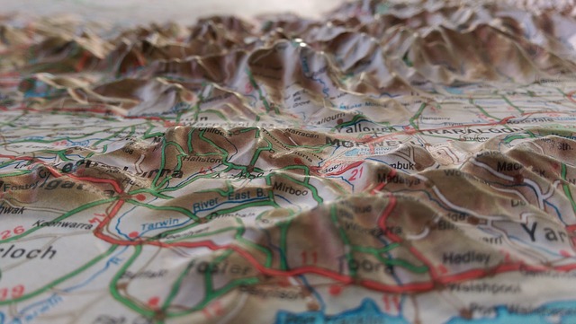
If you spend much time in the backcountry, you have probably considered getting an app with GPS tracking and topographic maps. Nothing can replace paper maps in terms of reliability (as long as you keep them dry), but GPS apps have come a long way. Another good alternative is something like the Garmin InReach Explorer+, which has topo maps and real-time GPS navigation as well as satellite messaging. You can learn more about that device and other options in our article about the Best PLBs and Satellite Messengers.
Being able to use your smartphone to see exactly where you are, plan routes, and track your progress is nothing short of amazing. In this article, we’ll look at and compare two of the premier backcountry GPS apps: Gaia GPS vs Backcountry Navigator Pro.
Paper or Plastic?
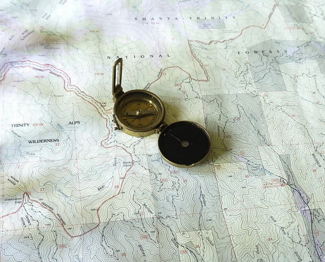
One thing to note before reading on is that mobile phones are not something that should be considered 100% reliable in the backcountry. Ideally you’ll have a physical map (in a waterproof sleeve or laminated) and a compass as a backup or at least know exactly where you are going. Or, if you can afford it, a dedicated GPS device with maps is pretty amazing.
There are a bunch of things that can happen that can cause your phone to fail. In very cold weather, batteries tend not to last very long, especially batteries that are a few years old.
On a warmer day, you might get super sweaty and if your phone is in your pocket it could get wet. This actually happened to me a few years ago – I had a blackberry (old school) in my shell pants pocket, and by the time I got to the top I had worked up quite a sweat. I pulled my phone out, and the screen was a bit damp and it wouldn’t boot up! There is also the risk of impact in a crash damaging your phone. This isn’t very likely if you’ve packed it safely, but it could still happen.
Moral of the story: don’t rely exclusively on your smartphone as a navigation device. Carry a compass and map(s) if you aren’t sure where you’re going.
The Best GPS Navigation Apps
The two GPS mapping and tracking apps that we’re going to look at today are Backcountry Navigator Pro and Gaia GPS. They are both available on Android and Gaia GPS is available on iOS (Apple devices) as well. There looks to be a new version of Backcountry Navigator Pro called Backcountry Navigator XE coming out sometime soon that will be available on iOS, but it isn’t yet available.
The Old Favorite: Backcountry Navigator Pro
For many years, the best GPS Navigation app for Android was far and away Backcountry Navigator Pro, which is called Backcountry Navigator Topo GPS in Google’s app store. The developer is an experienced Windows developer, and used those skills to build a very useful and fully featured Android GPS navigation app.
Stats
Number of installs: 100,000+
Reviews: 6,172
Rating: 4.5/5
Price: $11.99 USD
Current Version: 6.7.9
Website: http://www.backcountrynavigator.com/
Google Play Store: Download Link
iTunes: n/a
Feature Overview
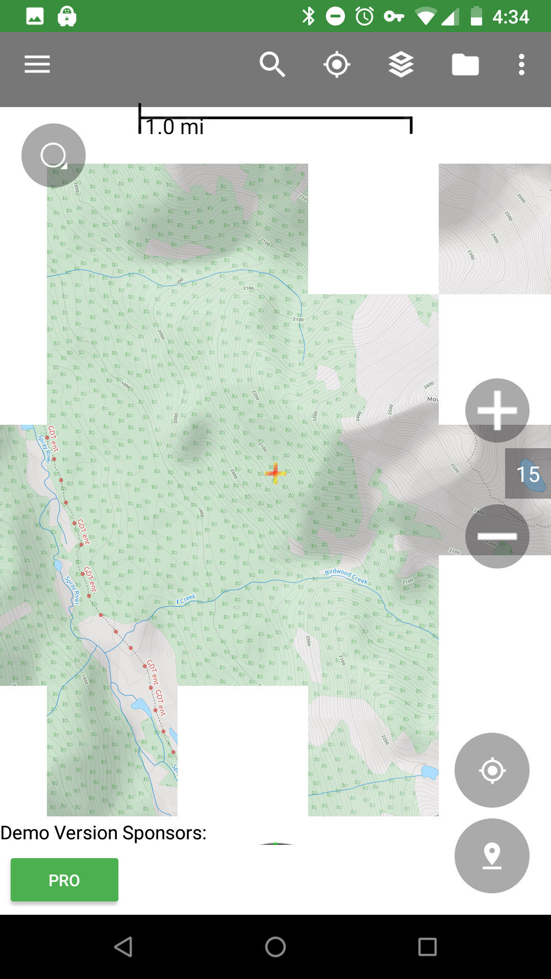
As a GPS navigation app, Backcountry Navigator Pro is great. There is a huge number of different map sources that you can choose from for different areas of the world. Topographic maps for North America are plentiful and switching the map source is quite painless. You can even download maps for offline use, which is great for backcountry travel since you often lose signal in the mountains.
The GPS quickly locks onto your current position, and recording a track is a breeze. You can also drop waypoints anywhere you like and even customize the icon and label. This is a great way to mark that secret hut that you found. Maps have 15 layers of zoom, which in most cases is plenty to see the relevant topo features.

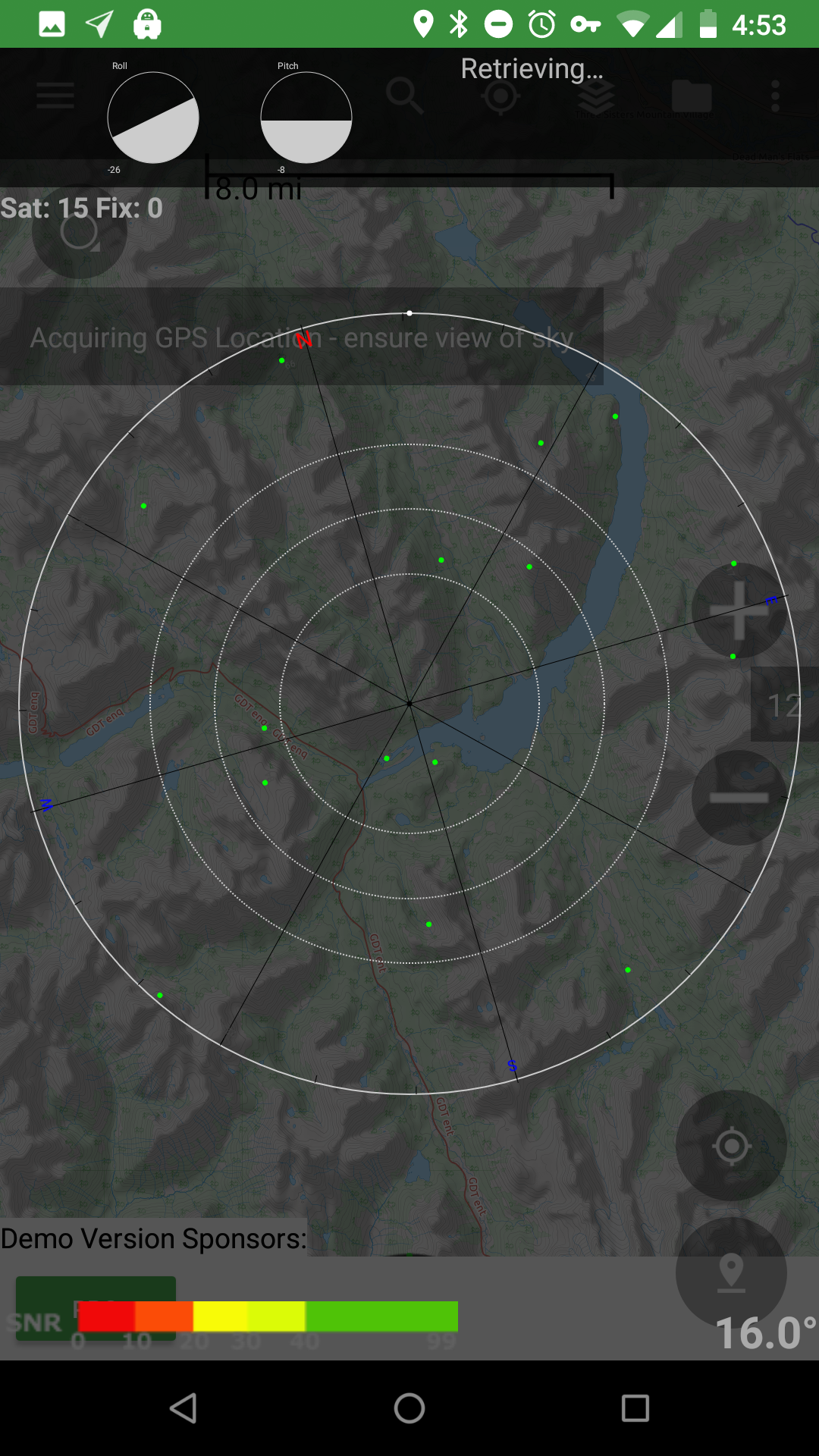
One interesting feature is the GPS Satellite View. This shows you where satellites are in the sky relative to your position, so if you aren’t getting a good signal, you can move to the right spot to acquire one. Neat! You also have the option of turning off GPS temporarily to save battery, which is definitely useful if you’re out in the backcountry.
Aside from the navigation and topo features, it has an integrated compass that uses your phone’s hardware, so the reliability is somewhat questionable. There is also a ‘trip database’ where you can see your recent trips, export GPX files and share them via text message, email, whatsapp, etc.
If you aren’t sure you want to purchase this app, there is a free 21-day trial that is supported by ads.
Review
Although Backcountry Navigator Pro has all the features you would want in a GPS navigation app, it’s starting to feel a bit dated. When you zoom in or out on a map, white blocks appear – briefly in most cases, but it isn’t a smooth transition. Same deal if you move the map – it feels a bit laggy. There are also a TON of help screens that pop up the first time you do anything in the app. You can check a box to ignore them later. They can be helpful, but are pretty wordy. I generally ignore them unless I can’t figure something out.
Adding waypoints is really easy – you hold your finger on the map and it drops a point. You can then see the elevation and coordinates of the point, customize the icon, and give it a name. Tracking a route is also really easy – two taps and the app will start tracking your progress and save it to be viewed on the map later.
Downloading maps for offline use is possible but isn’t the most intuitive process. You select the layers button, tap Select Areas for Download and then drag to create a rectangle (or a few of them) with your finger. Click the download icon, and you then select the level of zoom you want to download (this determines the file size). There are 3 Map Package options…what these do is either store the downloaded ’tiles’ (section of map) with the online maps or separately. Not sure how useful this is, but if you want a bunch of small, separate map tiles you can do that. Downloading is fast, so that’s cool.
The Future of Backcountry Navigator Pro
The website for Backcountry Navigator Pro doesn’t have any activity on it since August of 2015. From all appearances, it seems that development work has really slowed down on this app. I did a bit of digging and found a Kickstarter campaign that has been fully funded for a new app – Backcountry Navigator XE. This will be available on iOS as well as Android, which is a first for this app. According to the campaign, XE will be released sometime in the very near future – the estimated delivery date is May, 2018 (it’s June 4, 2018 as I write this).
Backcountry Navigator XE
Update: there has been some progress on Backcountry Navigator XE development! There was an update posted to their IndieGoGo page on June 29th. There will be a beta for Android and an iOS Testflight (a beta for iOS devices I’m assuming) sometime very soon.
Update 2: the beta for Android users is live! To try it out, you can opt in using this link. It isn’t quite ready to fully replace Backcountry Navigator Pro yet (it’s still a beta after all), but it’s getting closer. Users can see trips they create in XE on bcanavxe.com, and there are many more improvements to come in terms of stability and functionality. The development team is working toward the iOS (Apple) beta release and improving the existing features.
If you already know you want this app, use the promo code EARLYFOR25 for 25% off through the website (try AUGUST20 if that one doesn’t work). There are also multi-year deals through the indiegogo page linked above.
Here is a screenshot from the beta version of the app. I haven’t used it much yet, but it definitely looks a heck of a lot better than BCNav Pro.
I’ll post a link once the iOS beta is live. So far the new version of the app is looking very promising and I’ll post a full review and updated comparison when it is officially released.
The New Favorite: Gaia GPS
Well the title kind of gives it away, but since using Gaia GPS for a few trips last winter I don’t think I’ll be going back to Backcountry Navigator Pro. Read on to find out why.
Stats
Number of installs: 100,000+
Reviews: 1,745
Rating: 4.3/5
Price: Free – $39.99/year
Current Version: 7.0.7
Website: https://www.gaiagps.com/
Google Play Store: Download Link
iTunes: Download Link
Pricing
Gaia GPS’s pricing is a bit different from Backcountry Navigator Pro. The basic app is free, but you are somewhat limited in what you can do. You only have access to the default map source (Gaia Topo) and you cannot download maps for offline use. If you’re a casual backcountry traveler, this might be enough. But make sure you have a cell signal where you’re going.
The next level up is called a Membership, and it’s $19.99/year. This gets you access to an extensive map catalog that spans worldwide topo, road, and satellite. You can also download maps for offline use and print them as backups. For the truly committed, a Premium Membership at $39.99 per year gets you access to even more map libraries. These libraries include National Geographic Trails Illustrated, US Hunting maps, additional specialized overlays, and more European maps. There is a lot of extra content with a Premium membership, but it won’t be useful for everyone. Take a close look at what is offered before deciding.
After installing Gaia, if you wait a day or two you might see an email with discounted membership options. If you commit to a longer membership you’ll get a pretty good discount too.
Feature Overview
In terms of basic features, Gaia GPS covers pretty much all of the same bases as Backcountry Navigator Pro, but does some things a bit better. The community around Gaia GPS seems to have a lot more support. There is an online repository of maps and routes that people have shared, and it’s very easy to share your own routes from the app. The first thing you’ll see when you visit their website is a live map, which is handy for trip planning. If you navigate to the ‘Trips’ section, you’ll see all of the routes that people have shared and you can easily download these to your Gaia repository.
Recording routes, adding waypoints, downloading maps for offline use, and sharing routes are all supported features. Note that for most of these you’ll at least need the Membership level subscription.
GPS locks on just as fast as Backcountry Navigator Pro and there is also the option to make the map full screen which is handy when you’re looking at finer details on topographic maps.
Review
The map interface for Gaia GPS is head and shoulders above Backcountry Navigator Pro. Moving the map around is smooth, and zooming in and out is lag free. There are no little black boxes to wait for while the map is loading like you see in Backcountry Navigator. Once in a while you’ll see a grid until the map loads, but it isn’t nearly as prevalent as the competing app.
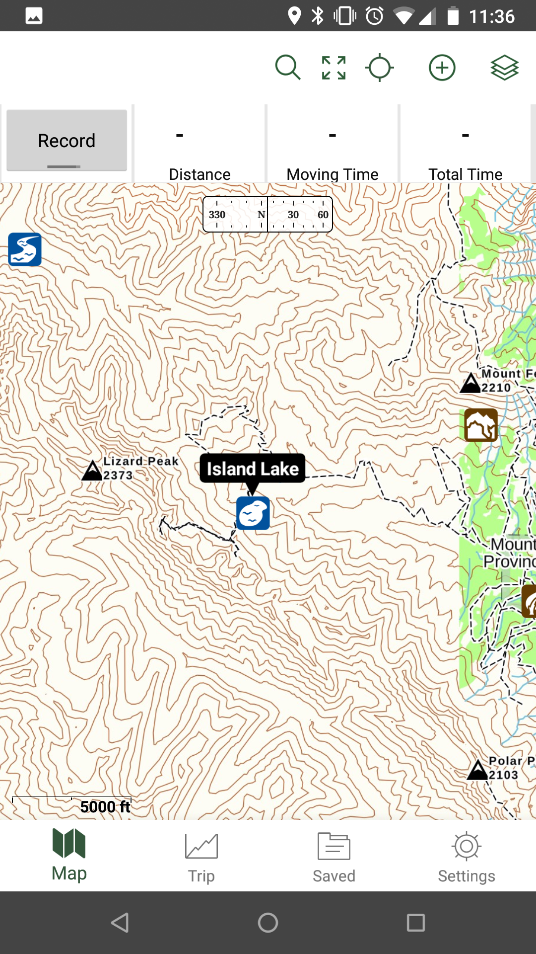
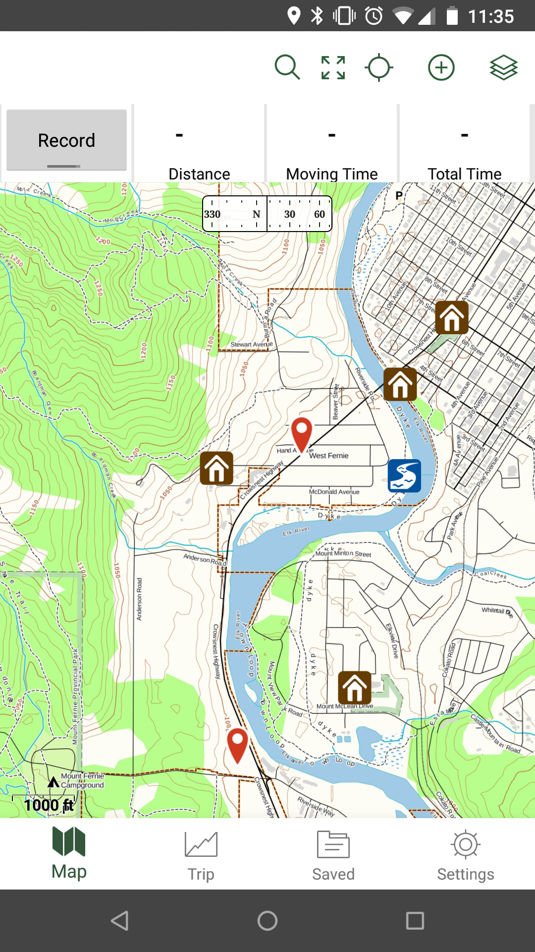
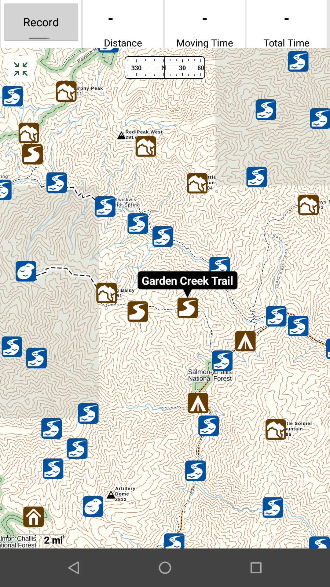
Recording a route is easy as pie – simply click the big Record button in the top left. Once you complete your trip you’ll have access to all kinds of stats like distance, speed, and time, as well as export and sharing options. Dropping a waypoint is equally painless – simply tap and hold on the map and a waypoint will appear.
If you have a Premium membership, there is a plethora of additional layers you can overlay on the maps and the selection of maps is almost overwhelming. That said, Backcountry Navigator gives you access to a huge number of maps at a lower price point than Gaia GPS.
One other interesting feature is the ability to take a picture with your device and tag it to a geographic location. This is very useful if you’re sharing routes with friends.
Comparison: Gaia GPS vs. Backcountry Navigator Pro
Overall, Gaia GPS is a much more polished app that feels like a modern smartphone application. Backcountry Navigator Pro gets the job done, but feels like it hasn’t aged very gracefully. It’s like a 15 year old Tacoma – it’ll get you there, but not in the most convenient or fashionable way.
But you have to consider the price point of these 2 apps. Gaia is a membership subscription based pricing model, where you will send them some hard-earned money every year. Backcountry Navigator Pro, on the other hand, is a one-time fee for access to a huge number of maps.
So the choice is yours…new, polished, but on the expensive side (Gaia GPS) or a bit older but still very useful (Backcountry Navigator Pro).
Unless you need a GPS app right now, you may want to wait and see what Backcountry Navigator XE brings to the table. If the user interface has been improved and the existing functionality is maintained, it could be a good purchase if the price is right.
8 thoughts on “GPS Navigation Apps: Gaia GPS vs Backcountry Navigator Pro”
Really interesting post!
BCN, I’ve been trying use this shitty app for two years. Down loading topo is time consuming and the files radomly disappear. I have wasted so much time attempting to make this work. I need an app that will let me download topos in unusual parts of the world and then find myself using GPS. I would also like to download kmzs. This promises you can do that but then other issues make using the programs completely impossible. If anyone knows of any other apps that can do this please comment below
Wouldn’t it be great if both apps provided a rangefinder interface so that users could add remote target markers to their maps – especially for hunters?
Are both useful for snowmobiles in extreme backcountry? Or road and Mountain bicycles in the summer ?
I wouldn’t recommend using a phone app as your only form of navigation in the extreme backcountry. You run the danger of running out of battery or the phone breaking. As long as you’ve downloaded maps either would work, but make sure you have a backup plan (paper maps or another GPS mapping device).
Backcountry Navigator has the ability to use openandroidmaps.org. So you can get a vector topo for an entire state and not have to worry about downloading tiles. I find this map to be by far the most used because it is too much work to always be downloading an area you are going to. And yes Gaia has some really cool layers but I use BN more
I run https://Bivouac.com (Canadian Mountain Encyclopedia) and I have spent hundreds of hours working with the developers of Gaia and Backcountry Navigator to add features to their Android version. We have a system of map overlays that allow Bivouac roads, trails, mountains and huts to show up on the maps. At present, Backcountry Navigator is still my preferred app for Android, because of a few critical things such as custom symbol support. I’ve used Gaia numerous times and it is a high quality app, and is what I would recommend for iPhone users.
Very good comparison, even though most of the time I use my Garmin GPS for hiking I do use Gaia GPS app and found it very useful. Also would like to read a review about Sygic if possible
Comments are closed.